Reimagining Rural Regions (R3) Program

R3 Overview
Across Ohio and the United States, the economic, cultural, and technological divide between larger cities and communities and rural small towns has never been greater. As rural communities look to bridge the gap between themselves and larger communities, it is important to understand that today’s workers, and in particular young, high-skilled workers, are making decisions on where they will live not based solely where there are employment opportunities, but also on the amenities, assets, and experiences available in communities where they feel they can lead interesting, meaningful lives.
Despite the disruption caused by the pandemic, new economic trends such as the decoupling of work and place, including the increase in remote work arrangements, provide opportunities to increase the economic resiliency and quality of life of residents while attracting new talent and companies in rural communities across the region. As a public university for the public good, Bowling Green State University (BGSU)’s Center for Regional Development (CRD) developed the Reimagining Rural Regions, or R3, Program to provide expertise and capacity to assist communities to undertake a placemaking process to identify assets that could be reimagined in an effort to improve quality of life and to aid in the retention and attraction of talent.
We have made some adjustments to the program to streamline the process for applicant communities and are currently accepting applications for the R3 program. Applications will be accepted and reviewed on a rolling basis. We anticipate that we will work with 3-4 communities each year.
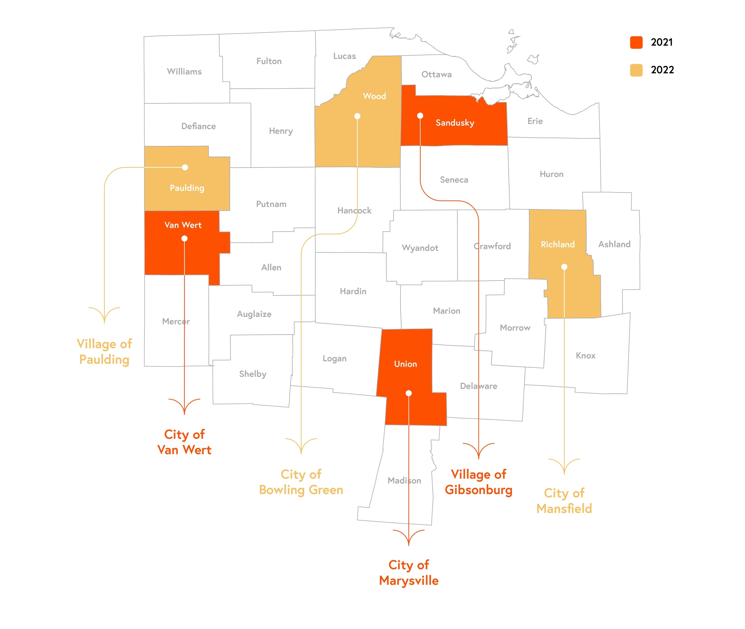
Our R3 Communities

2021–2022
2022–2023
Community Eligibility
- Communities and/or counties must be rural in character with a population of 50,000 or less.
- A community's application must be submitted by a lead applicant that is a public or non-profit organization located in the applicant community.
- The community must commit to fully engaging and participating in both the placemaking and implementation process, including committing to identifying a community steering committee to lead the effort. The entire process is estimated to last between three and five months
The following entities meeting the eligibility requirements above are encouraged to apply:
- Municipal, tribal, or county governments within the CRD 31-county service area.
- Local or regional non-profit organizations, including economic or community development organizations, chambers of commerce, or convention and visitors' bureaus (CVBs) serving rural communities in the CRD service area.
- Partnerships of the entities listed above are encouraged to apply.
FAQs
Based on feedback, we have streamlined this planning process from one year down to roughly 3-5 months. This reduces the commitment for the community steering committee. We have eliminated the undergraduate component, but the rest has remained the same.
Much of the process will be driven by the community and steering committee, but our typical process includes activities such as interviews, a community-wide survey, and SWOT analysis.
Application process and community selection:
- Kick-off meetings, development of community steering committee for placemaking process (integration of BGSU students/alumni and possible local high school students on the committee)
- Public engagement to develop SWOT analysis and identify potential community projects
- Public engagement and education to discuss communtiy projects
- Steering committee selects 1-2 projects for further development
- Public engagement and identification of grant funding to better utilize the county fairground as a hub for family friendly activities and events
- Design public uses and amenities for a remediated brownfield (former gas station)
- Models for a public-private partnership to provide recreational kayaking at a local quarry
- Identify challenges to existing downtown business owners with keeping more traditional hours and suggesting mitigation strategies
- Develop way-finding strategies
- Create a plan for public art
Updated: 02/12/2024 04:00PM


.jpg)


.jpg)
