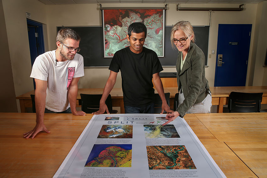
‘Spatial Literacy’ exhibit shows relationship between art, science

By Julie Carle
Big, bold colors and interesting designs will be on display later this month in a special, one-day art exhibition at Bowling Green State University. The secret behind these magnificent images, however, is that they are not made with paint, watercolors or any other usual art medium. Instead, the exhibit — “Spatial Literacy through Art” — melds art and science.
The exhibition, from 9 a.m. to 5 p.m. on Sept. 29 in 208 Bowen-Thompson Student Union, is free and open to the public.
Dr. Anita Simic, an assistant professor of geoscience in the School of Environment, Earth and Society, and some of her students will display 15-20 pieces of art that come from their scientific work associated with remote sensing of the environment.
Remote sensing of the environment refers to the use of satellite, and aircraft or drone images to monitor features on Earth, Simic said. Remote sensing, which makes it possible to observe large areas, inaccessible areas and areas that cannot be disturbed, is used to monitor such phenomena as volcanoes, deforestation, agricultural fields, water quantity and quality, geological features, flooding, oceans, ice, coastal areas and vegetation changes. Even the Lake Erie Watershed will be included because of the recent focus on water quality issues there.
The raw data acquired by remote sensing equipment measures reflected light energy from objects in the form of digital numbers. Science magically becomes art when computers translate digital numbers into colors, Simic said.
“With a click or two, red, blue and green colors are assigned to digital numbers and remote sensing transforms into art,” she said.
Each image in this exhibition is accompanied by its own story displayed on a poster to help viewers understand Earth’s natural beauty and the environmental problems that are part of every day. Each story contains information about which satellites were used to acquire data and about the environmental beauty or problems related to the area.
“This capability of combining a vast spectrum of light wavelengths with these colors allows us to observe Earth’s aesthetic beauty where textural details of features such as algal bloom, forest cover, agricultural fields, ice or wetlands become ‘visual pleasure beyond scientific interpretation,’” she added.
From her own perspective, Simic recognizes the opportunities she has as a remote sensing scientist “to stop everything for just a minute and simply enjoy the beauty of displayed images.
“The show is meant to attract people who enjoy art to trigger their interests in understanding the images as a part of science, and to attract all who like science to recognize its importance and beauty through these colors,” she said.
The event, which includes refreshments throughout the day and videos of how the work is done, is sponsored by AmericaView and the U.S. Geological Survey.
Updated: 12/02/2017 12:24AM
